Jersey Geology Trail |
||||||||||||||||||||||||||||||||||||||||||
Superficial Deposits. |
||||||||||||||||||||||||||||||||||||||||||
 |
||||||||||||||||||||||||||||||||||||||||||
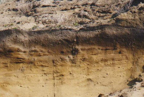
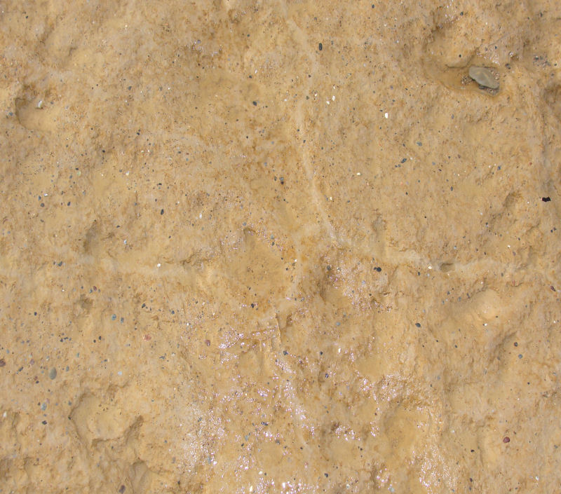
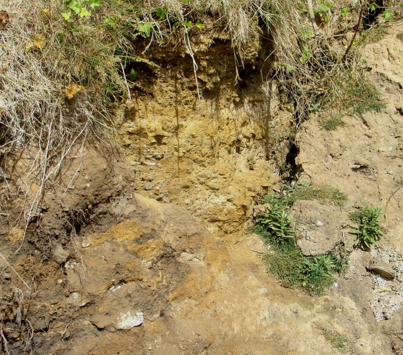
Sands, gravels and organic layers; Sand Pits, St. Ouën's Bay. |
||||||||||||||||||||||||||||||||||||||||||
All around Jersey, superficial deposits form a great variety of unconsolidated sediments which generally rest on the eroded surface of the bedrock. From youngest to oldest, they comprise present day beach sands and pebbles, terrestrial silt (stream & marsh alluvium), beach silty clays (some with grit/gravel layers), peat with tree stumps and branches, sand dunes with thin gravels and organic layers, older sand, pebble beds forming three raised beach intervals interbedded with silty clay (loess) and glacial head. They were deposited during the Quaternary in the following British stages of the Pleistocene and Holocene epochs given in years Before Present (BP). |
||||||||||||||||||||||||||||||||||||||||||
|
||||||||||||||||||||||||||||||||||||||||||
In Jersey, the plateau surface is covered by various soils overlying glacial head and loess, while the valleys contain silt, sand and peat, and the beaches consist of sand, grit and pebbles overlying various coloured clays and in some areas, peat with tree roots and stumps forming a 'submerged forest'. At the back of some beaches, the cliffs consist of sand, raised beach pebble deposits and glacial head. Several wet land areas and former marshes exist with silt and peat intervals on the east and south coasts, while on the west coast, extensive sand dunes have formed along St. Ouën's Bay, the highest along the fossil cliff line at the southern end where there are blown sand deposits stretching eastwards across Les Quennevais. These rest on peat with tree stumps of alder (Alnus) and beech (Betula), occasionally revealed between Le Port and L'Ouzière near the sea wall. The deposits are described in detail by Bishop & Bisson (1989, p. 82 - 94) who cite the work of other authors in determining the ages of the different deposits, and in thorough, comprehensive detail in the Past Landscapes of Jersey (Jones, Keen, Birnie and Waton, 1990). The deposits are briefly summarised below with personal observations included. |
||||||||||||||||||||||||||||||||||||||||||
|
||||||||||||||||||||||||||||||||||||||||||
Holocene (Recent).Beach Pebble Deposits (present day). |
||||||||||||||||||||||||||||||||||||||||||
 |
||||||||||||||||||||||||||||||||||||||||||
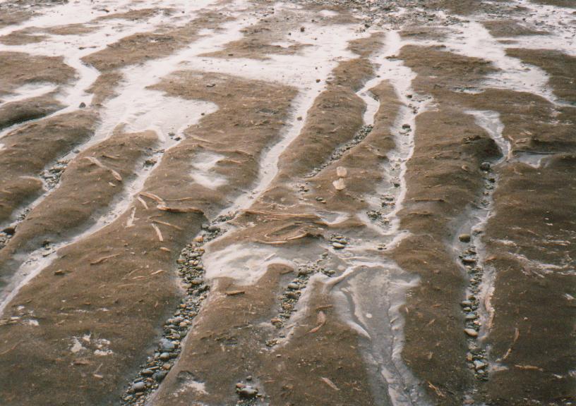
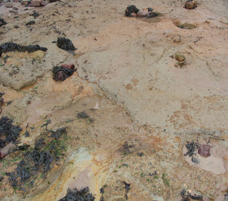
Modern storm beach gravels over sand and 'submerged forest' deposits St. Ouën's Bay. |
||||||||||||||||||||||||||||||||||||||||||
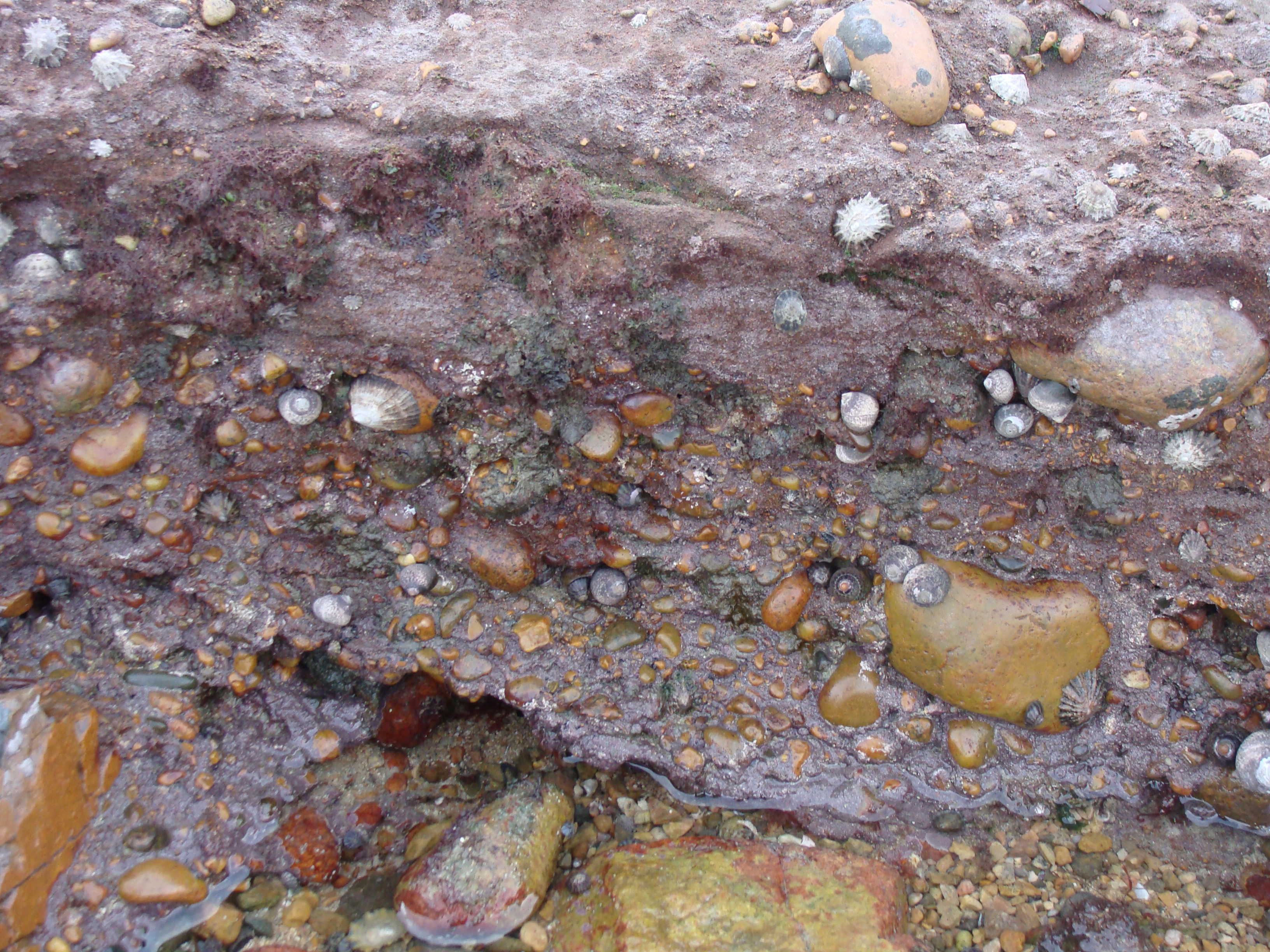
These occur on some of the beaches as pebble deposits which are protected by law from collection (and export from the island as personal specimens). They have been produced by erosion of the island's cliffs and deposited during high spring tides or storm conditions as shown below. All the rock types are represented and individual types predominate nearest to outcrops of the parent rock. Admixtures of others provide potentially interesting studies of their provenance with respect to tidal streams. Rocks which occur but are not native are thought to have been jettisoned ballast, except for flint which occurs on the sea floor to the north. |
||||||||||||||||||||||||||||||||||||||||||
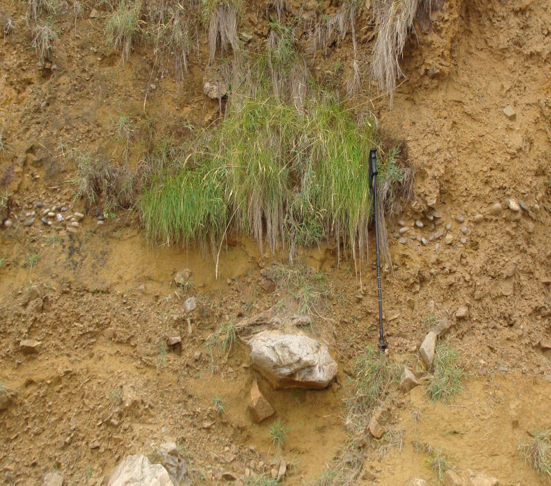
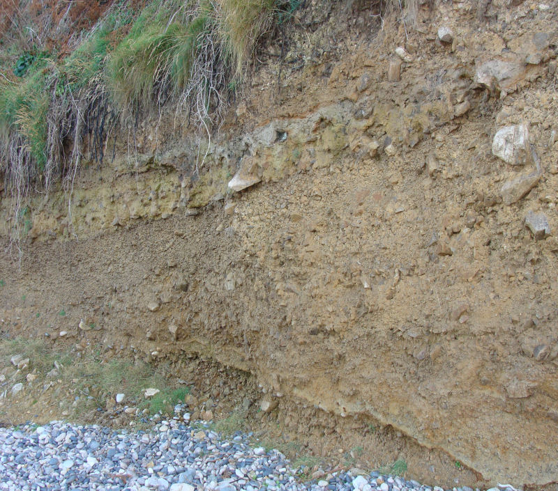
Sand dunes (Holocene, Flandrian).Sand is technically, particles of any colour and composition between 1/16mm and 2mm in size. Jersey is renowned for its golden sand beaches but some are grey and others are orange to pink. The sand grains are mainly quartz with orthoclase feldspar which gives the orange and pink colours but some biotite and muscovite flakes also occur. The white particles are finely comminuted shell fragments. These are obviously marine sands, formed by wave erosion of the cliffs and transported by the tidal currents and long-shore drift, which have been accumulating recently as the sea level has risen around around the former coastal plain plateaux and turned them into the present Channel Islands. |
||||||||||||||||||||||||||||||||||||||||||
 |
 |
|||||||||||||||||||||||||||||||||||||||||
High dunes and dune bedding in blow-out, La Tête des Quennevais. |
||||||||||||||||||||||||||||||||||||||||||
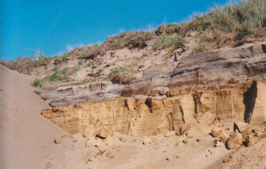
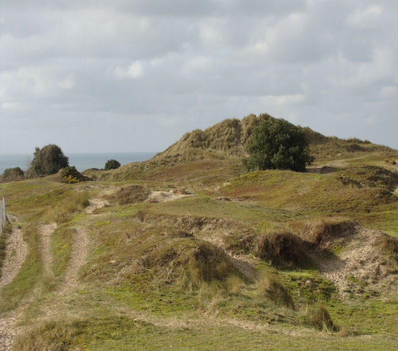
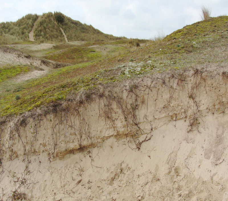
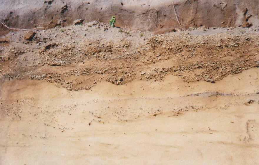
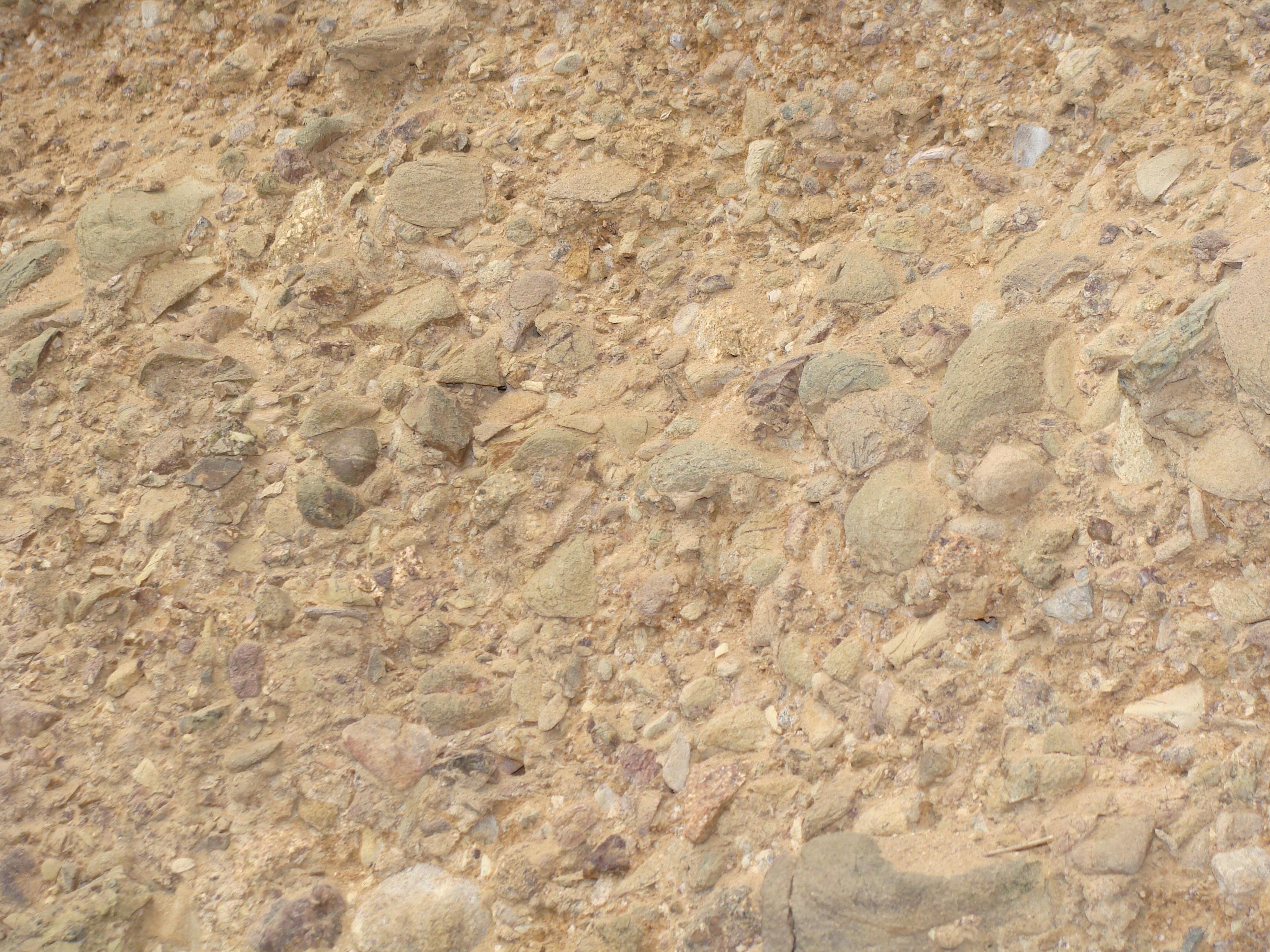
Other sands are aeolian and form the high dunes of the west coast which are stacked up high against the fossil cliffs and also lie on top of them in the southern part of St. Ouën's Bay to the north of La Moye Golf Club. These are thought to have formed from c. 5000 years ago as onshore winds transported sand from the beach areas as the sea level rose around Jersey. They are anchored by marram grass, except in the blow-outs, but these wind blown (aeolian) sands have also been blown across the high plateau, eastwards to Les Quennevais where they may have given their name to the housing area of Le Clos des Sables. Dunes also occur along the southeast coast in the Royal Bay of Grouville, and sands form narrow strips in the south along St. Clément's Bay, St. Aubin's Bay, St. Brelade's Bay and Ouaisné, and in the north along the back of La Grève de Lecq. In parts of St. Ouën's Bay, the sand has been extracted for the construction industry and these small open cast pits revealed stratified sand beds and interbedded thin soil horizons some with terrestrial gasteropods. Gravels also occur in these sands as thin strings and layers of varying thickness, some exhibiting cut and fill structures. Some Neolithic flint and pottery remains were found at Les Blanches Banques, and the small allée couverte at La Ville ès Nouaux by St. Andrew's Church to the west of First Tower was partly buried at this time. One sand extraction pit remains working in the southern end of the bay in the flat area between the beach and the dunes. In the "cliff "walls of the pits a detailed sequence (c.5m thick) of the sand stratification and gravel intervals can be seen, reported to be resting on a clay layer, hence the standing water (Jason Simon, manager, pers. comm.), which may be just above the peat at Le Port, to the west at beach level, or equivalent to the predominant clay below L'Ouzière, the next slipway to the north (Jones et al, 1990, fold-out 2a & 2b, facing page 36). |
||||||||||||||||||||||||||||||||||||||||||
 |
 |
|||||||||||||||||||||||||||||||||||||||||
Sands with gravels in cut and fill structures. |
Sands & peat horizons. St. Ouën's Bay. |
|||||||||||||||||||||||||||||||||||||||||
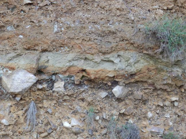
Peat (Holocene, Flandrian).The largest peat deposits occur in St. Ouën's Bay at L' Ouzière slipway, at Le Port to the south and La Saline to the north. They are said to be part of a 'submerged forest' and the thick, spongy brown peat layer contains tree stumps and roots of Alnus and Betula. It has been dated at 3980 years, suggesting that sand deposition started as the sea level was rising around the islands. It is thought that the great tidal range (c.13m) on spring tides allowed time for the sand in the bay to dry out in between tides and for the predominantly westerly winds to blow it ashore where the fossil cliff line blocked it and caused the dunes to form. The relict soil horizons formed during periods of still-stand (or brief regression?). The "forest" is said to have been submerged during severe storms and surges during the 15th.C. An older sand is recorded by Bishop & Bisson (1989, p. 86.) near the airport in St. Peter which underlies loess in an isolated outcrop. Other coastal peat beds, occasionally revealed, occur in St. Brelade's Bay and at La Grève d'Azette. |
||||||||||||||||||||||||||||||||||||||||||
 |
||||||||||||||||||||||||||||||||||||||||||
Peat beds with stems at Le Port, St. Ouën's Bay. |
||||||||||||||||||||||||||||||||||||||||||
Peat deposits also occur with valley alluvial silt deposits and where the streams enter the sea along St. Aubin's Bay on the south coast and where Queen's Valley opens onto the eastern coastal plain. The marsh land of Grouville Marsh and Le Marais à la Cocque, and St. Peter (Le Marais de St. Pierre)) also contain thick deposits. Thicknesses vary from 8.5m in the marshes to1m in the coastal areas (Bishop & Bisson, 1989, p.92) and marine silts show there were some marine transgressions. The valley silts contain forest pollen spores and the oldest is reported from Quetivel Mill in St. Peter's Valley with a radio carbon date of c. 9,670 years, whereas the coastal peats vary from c. 4,000 years in St. Ouën's Bay (photo above left) to 3,150 years in St. Brelade's Bay (Ouaisné). Below St. Helier, a peat deposit 1.7m down yielded a date of c. 2,600 years showing continuous formation after the western areas had been covered by sand. A stony, silty peat occurs at the base of head at Fliquet on the northeast coast and wood fragments give a date of 25,500 years (Devensian) while the Coleoptera and pollen remains show the climate was sub-arctic. |
||||||||||||||||||||||||||||||||||||||||||
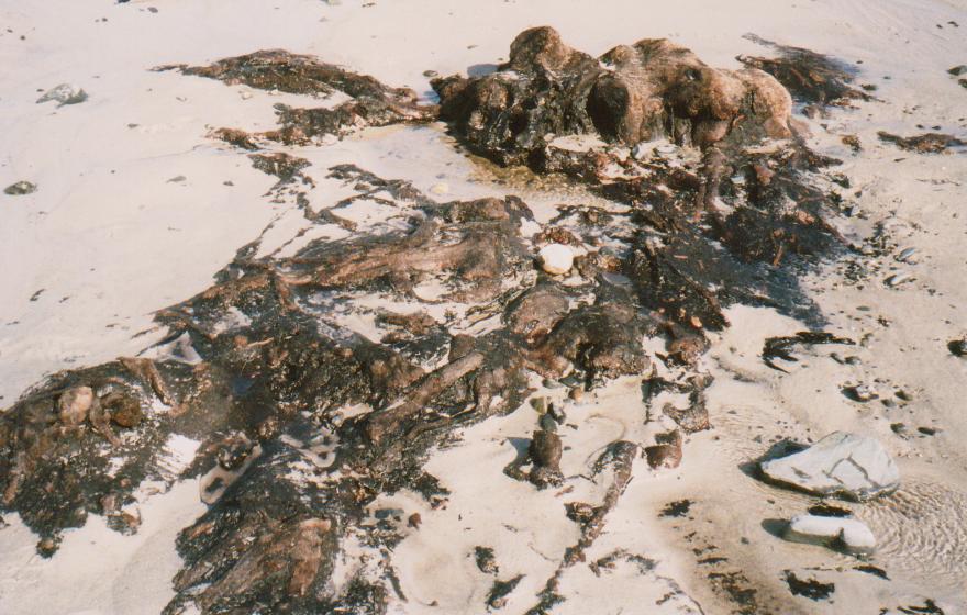
'Submerged Forest.' |
||||||||||||||||||||||||||||||||||||||||||
 |
 |
|||||||||||||||||||||||||||||||||||||||||
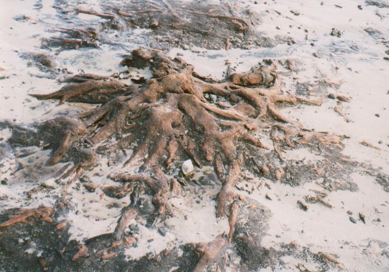
Tree stumps & roots, north of La Saline. |
||||||||||||||||||||||||||||||||||||||||||
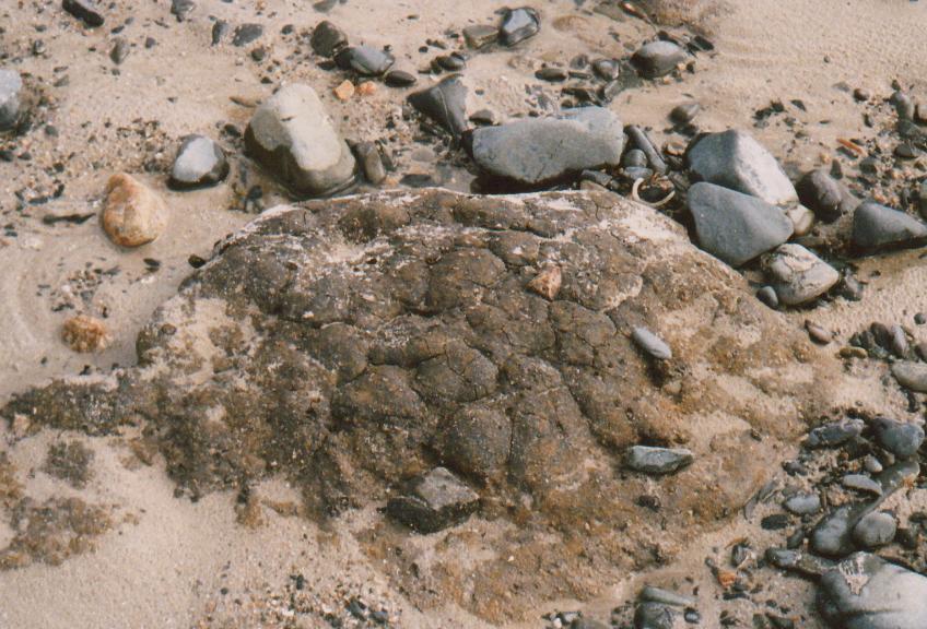
At certain times and tides, tree stumps of Birch (Betula) and Alder (Alnus) are exposed as parts of submerged forest areas around Le Port and L'Ouzière slipways and north of La Saline slipway in St. Ouën's Bay. Those north of La Saline were well exposed after the March '08 storms and high tides. The root systems are also well preserved and are surrounded by a brown spongy peat of the former soil profile. The spore and pollen content is given along with the peat, clay and sand stratigraphy and the palaeoenvironments by Jones, Keen, Birnie & Waton (1990, pp. 34 - 45). More photographs of the various appearances of the forest are on file in the Photographic Archive of La Société Jersiaise. An early report, preserved by Dr. A. Mourant in the Geology Section Library of La Société Jersiaise, describes the scene in St. Ouën's Bay on March 19th. 1787. "Yefterday I took a ride to St. Owen's Bay, to fee fome trees which have been lately difcovered within high water mark, with every appearance of a fallen foreft. They cover at prefent upwards of three fquare acres of ground, but feem to extend beyond all human reach into the fea. Many of thefe trees are entire, and meafure upwards of forty feet long, and it is evident that they have grown on the fpot, as their roots and earth ftill adhere. But what renders this difcovery ftill more wonderful is, that for many miles around this Bay, it is a barren fandy defert, and not a fhrub to be feen on it". Extract of a letter from Jersey, March 19 from The Edinburgh Evening Courant, Thursday, April 5th. 1787. The scene was also described later in the month in the Jersey Gazette as follows, "One needs to possess more than a human philosophy in order to imagine the astonishing revolutions that the face of the earth has undergone, since the start of time to the present: I do not mean the political revolutions; it is of the natural that I wish to speak. This little country that we inhabit has given us enough curious proof of them. The trunks and the roots of trees which were unscovered, by the movement of the sea, in the bay of St. Ouen, and which are still visible, give us a subject of contemplation of a time very long ago. One sees thousands of trees, lying near each other in this bay, from La Corbière as far as two banks of sand at some miles from the open sea. From this ancient debris one can only doubt that all this land, as well as that above, called Les Mielles, had not been at other times, rich grassland and thick forests, which have been submerged by some extraordinary event. Among the trees one sees very large ones, and it confirms that after a storm of particular winds, there appears so much sand above that it is very difficult for carts to pass. Perhaps the bays of St. Helier, of St. Clément and of Grouville, which are very wide, have suffered the same force, and the sea which is no longer rough in these places will reveal nothing similar to us; for it is noticeable that it is only rarely and after strong winds that these in St. Ouen's Bay become visible". (Paul Chambers, pers. comm. from original copy.). Translation of later report in French published in the Jersey Gazette, April 28th 1787, p.159-160. (Ralph Nichols). An unusual and rarely seen domed structure, of a brown sandy clay with grit exhibiting polygonal cracking, occurs within the above tree stump and peat beds north of La Saline slipway in St Ouën's Bay. It is c.60cm across and 30 cm high and looks similar to a pingo/palsa dome seen in periglacial Arctic regions. Possibly it is a relict miniature variety without the ice and without subsequent collapse... and sectioning would be destructive. |
||||||||||||||||||||||||||||||||||||||||||
 |
||||||||||||||||||||||||||||||||||||||||||
Beach silty clays (?Flandrian). |
||||||||||||||||||||||||||||||||||||||||||
 |
||||||||||||||||||||||||||||||||||||||||||
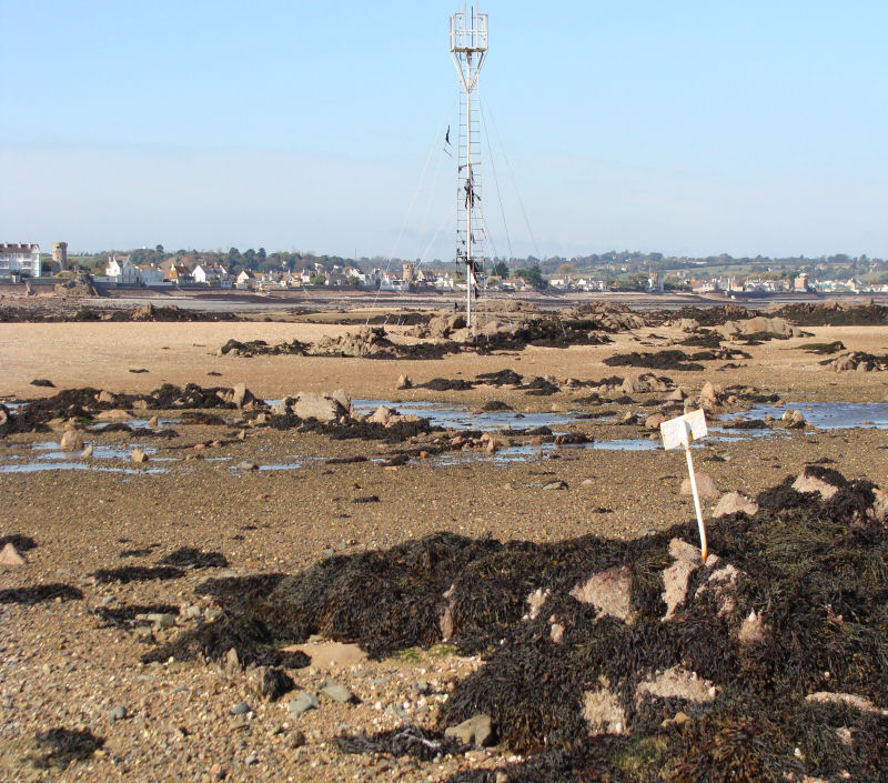
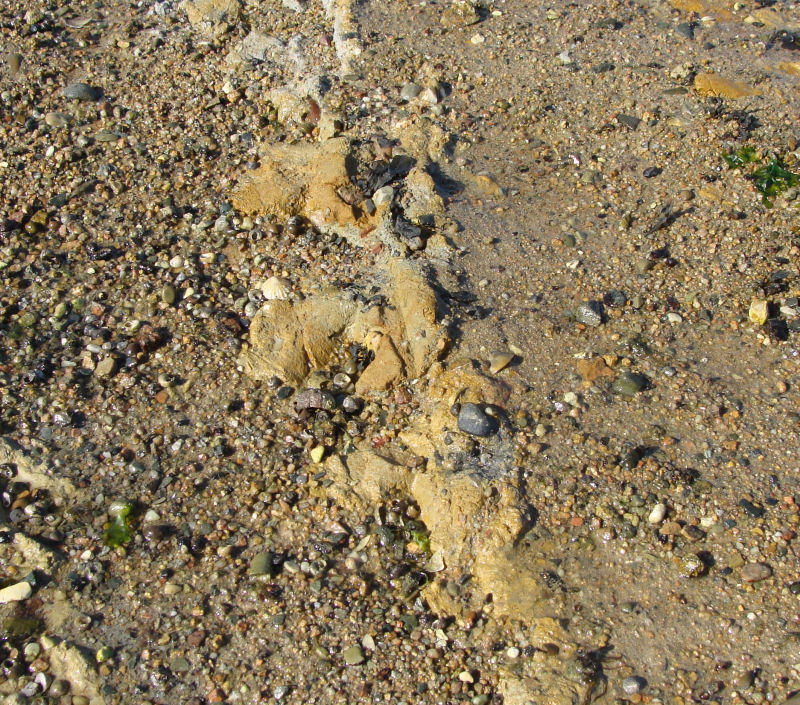
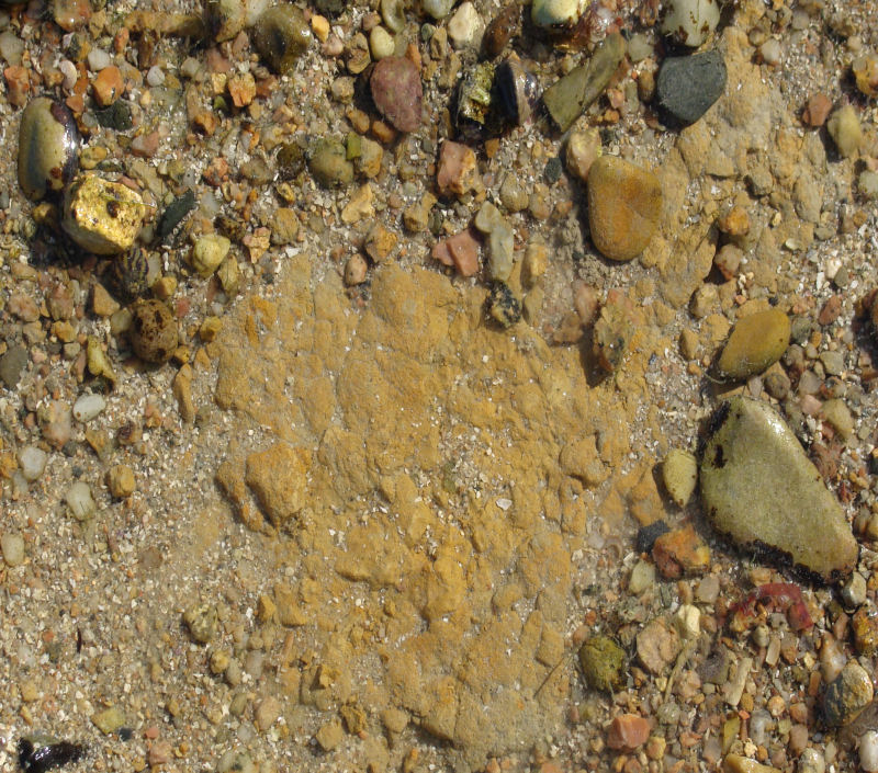
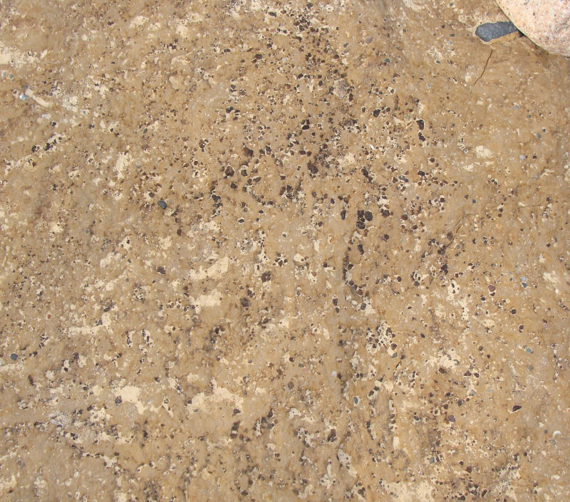
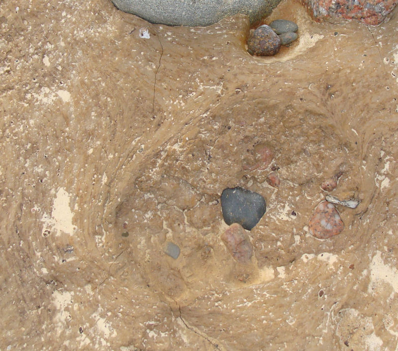
These silty clays, some yellow, loess looking, seem recent, and occur under present beach sand and pebbles between La Rocque Point and Seymour Tower, at the southern end of St. Catherine's Bay on the east coast; at the western end of St. Brelade's Bay in the south west where they are at the same stratigraphic position as the adjacent peat beds. La Rocque Pt. to Seymour Tower; the most extensive distribution at present is on the SE wave-cut platform and I am indebted to Dr. A. Hill for showing me these coloured silty clays which started me off on another trail! The grey to yellow-brown clays occur as 'windows' (inliers) within the present beach sand and gravels in this area and standing water often indicates the presence of clay below the sand and gravel. In terms of accessibility, the ones described below occur specifically within 100m north and south of the white marker track from Seymour Slipway, via a metal Refuge Tower (photo above) for c. 2km south eastwards to Seymour Tower. Search for them can take time because they appear and disappear as the strong tidal currents deposit and remove the sand or or grit cover, but exposures found during earlier visits have been GPS-plotted by Dr. Hill (pers. comm.)... and a spade rather than a hammer may be considered an extra piece of geological equipment for research purposes. They are best searched for by starting from Seymour Slipway c. 2hrs before Low Water Spring Tides and crossing the near-shore wide stretch of sand towards the Refuge Tower and the first of the white markers. This gives one time to explore the various pools but great care must be taken to time one's return as the Spring Tides flood quickly through the gullies between the granite and diorite outcrops. |
||||||||||||||||||||||||||||||||||||||||||
 |
 |
|||||||||||||||||||||||||||||||||||||||||
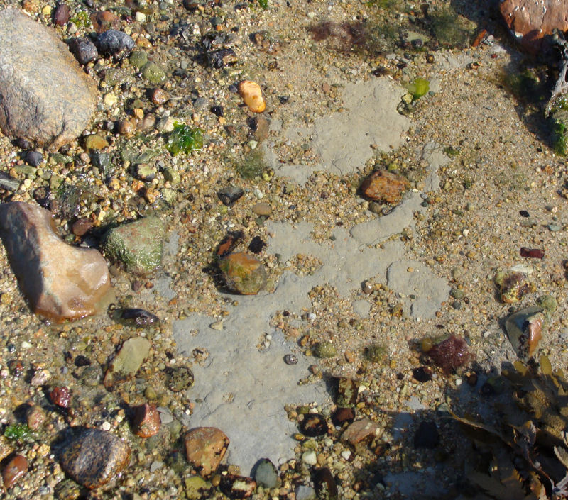
The grey to yellow-brown clay fractions are mixed with silt size quartz fragments, and in some cases, fine to coarse sand size possible lithic fragments or heavy minerals. They lie as stratified deposits in the eroded hollows between the granite and diorite of the uneven present day erosion surface. Some exposures (see above & below) show polygonal mud cracks while others have a shallow pool of water over them at low tide, while others have been exposed in tyre tracks of vehicles going to the Tower or the fishing trots. Detailed examination for fossils has not yet been done and their age has not been determined; it is hoped that this may be done by OSL and/or IRSL (Optically / Infrared Stimulated Luminescence. Roberts, 2008; Wintle, 2008) in the future. |
||||||||||||||||||||||||||||||||||||||||||
 |
 |
|||||||||||||||||||||||||||||||||||||||||
The only fossil to date is a mammoth tooth found by (Dr. A. Hill, pers. comm.). They are described as freshwater clays (Bishop & Bisson,1989, p.108) formed in supratidal lagoons but may be part of the loess deposits (Dr. J. Renouf, pers. comm.) and may have been deposited during the last glacial period (Devensian). To date, they have not been correlated with the clays recorded in the marshes (eg. Grouville, Jones et al.1990, p. 78) and valleys (eg. St. Peter's Valley, op.cit. pp. 93-95). South of Le Hurel slipway, a further 500m north of the Seymour slipway, a longer outcrop at a higher elevation occurs at the start of the high spring tide bank of pebbles against the sea wall, recently reported by Dr. Paul Chambers (Dec. '09, pers. comm.). |
||||||||||||||||||||||||||||||||||||||||||
 |
 |
|||||||||||||||||||||||||||||||||||||||||
It is light brown-yellow in colour, similar to some of the silty clays further south near Seymour Tower, and seems to be the silty clay with sand and grit variety but also with some black, possible carbon pieces (above right); more details will follow after examination by Dr. Chambers, and Dr.Hill who also visited the exposure. |
||||||||||||||||||||||||||||||||||||||||||
 |
 |
|||||||||||||||||||||||||||||||||||||||||
Pebbles resting on the surface seem to be sites of incipient pot-holing but in one case swirl marks occur in the silty clay around a pebble clast (above left), while possible relict dessication cracks (first photographed by Dr. Chambers) stand out as light coloured lines within the yellow-brown background colour (above right). In St. Catherine's Bay, further north again, at the southern end of the beach between Archirondel and St. Catherine's Tower, (photos below), horizontal layers of yellow and grey, silty and gritty clays can be seen among the beach gravels overlying the junction between the ignimbrites of the Bouley Rhyolite Formation and the Rozel Conglomerate, and possibly filling a hollow eroded along the junction. |
||||||||||||||||||||||||||||||||||||||||||
 |
 |
|||||||||||||||||||||||||||||||||||||||||
St. Brelade's Bay. In the western corner of the bay, yellow clay, similar to loess, occurs in hollows around the beach granite outcrops immediately north of the low breakwater These silty clays, again periodically covered by present sands and gravels occur at the same level as the peat beds periodically exposed in the beach to the east by the L'Horizon Hotel slipway. |
||||||||||||||||||||||||||||||||||||||||||
 |
||||||||||||||||||||||||||||||||||||||||||
Pleistocene.Loess (Devensian (?) glacial). |
||||||||||||||||||||||||||||||||||||||||||
 |
 |
|||||||||||||||||||||||||||||||||||||||||
Loess deposits off the south coast on La Motte (Green Is.). |
||||||||||||||||||||||||||||||||||||||||||
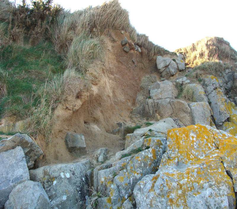
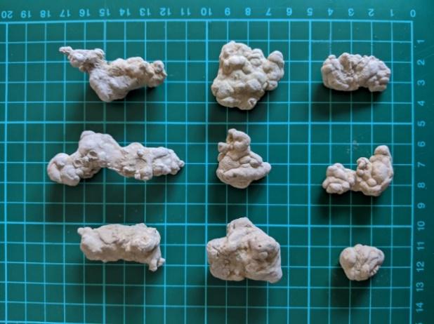
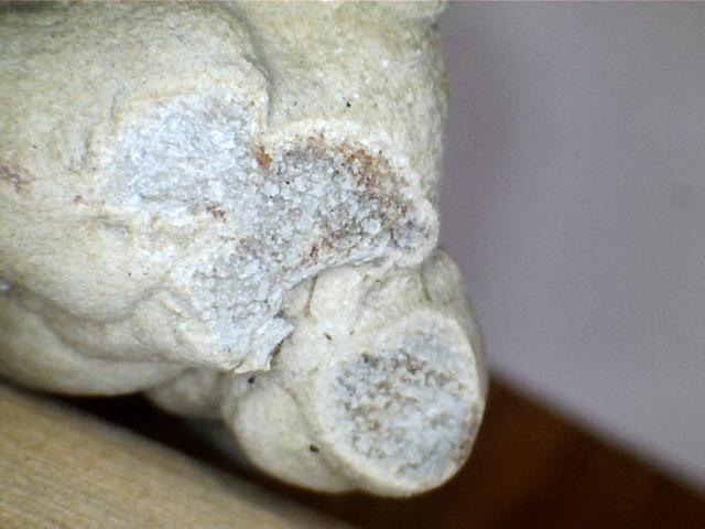
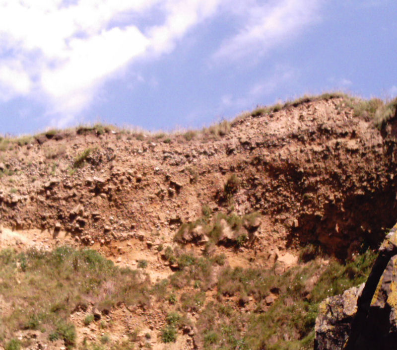
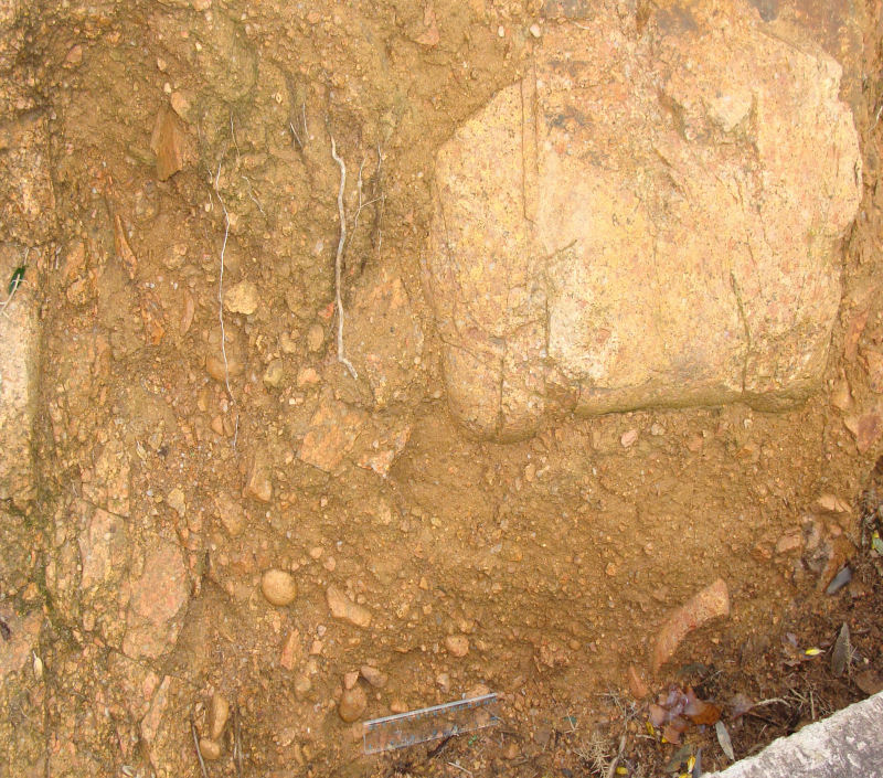
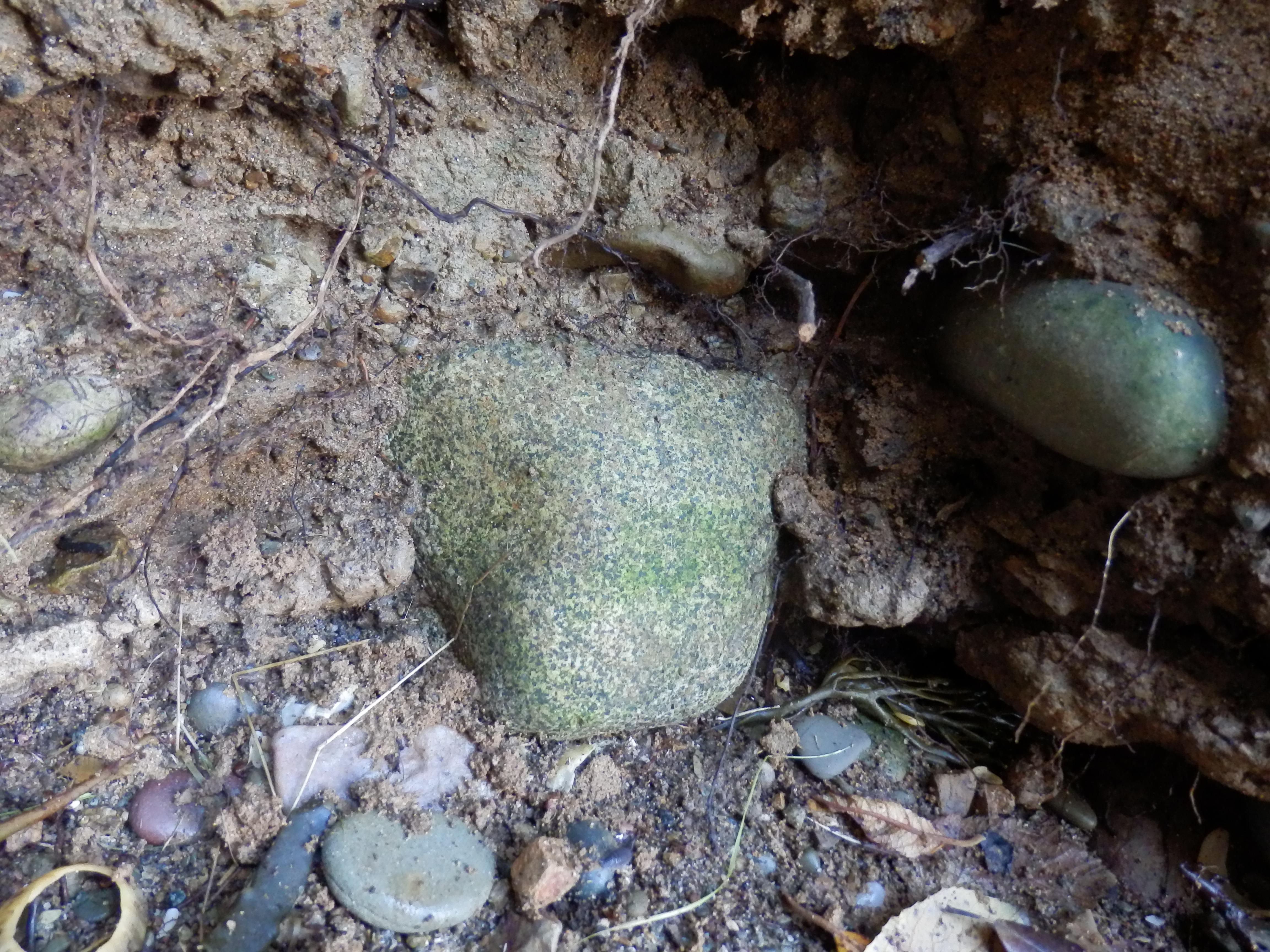
The Pleistocene clays and silts are the yellow and brown, wind-blown glacial clay-silts of the loess deposits and often crop out with glacial head on the cliff-tops and are described in detail by Bishop & Bisson (1989, p. 90-91). They also occur at various places in other bays and in road cuttings across the island and was used for brick making at Five Oaks and Mont à l'Abbé. It underlies the Maufant (maûfanc/fange = bad mire) area and thins westwards, which may imply a provenance from the Channel (Bishop & Bisson, loc.cit.), or from mainland Europe having been carried by easterly winds which would have been blowing clockwise out of the high pressure area situated over the ice cap to the north. The exposure on La Motte (Green Island) is a protected site and consists of loess with secondary, calcareous concretionary layers produced by decalcification. Recently, excellent examples of rare calcareous concretions were found by Mark Yates near La Mare slipway, St. Clément (photos below). They had only been reported previously by Bishop & Bisson (1989, p. 90) from La Motte (Green Is.) as redeposited calcium carbonate, discontinuous concretions (lössmännchen) of loess cemented by CaCO3. Here, as in Portelet Bay, St. Aubin and Belval Cove, the loess contains sparse, cool climate molluscan fauna (Bishop & Bisson, loc. cit. p. 91) which indicates deposition during glacial periods (possibly pre-Flandrian, in the Devensian) by winds from the north during periods of lower sea level, to be later overlain by aeolian sand. |
||||||||||||||||||||||||||||||||||||||||||
 |
 |
|||||||||||||||||||||||||||||||||||||||||
Calcareous concretions from near La Mare slipway, St. Clément. |
||||||||||||||||||||||||||||||||||||||||||
Head (Devensian glacial). |
||||||||||||||||||||||||||||||||||||||||||
 |
 |
|||||||||||||||||||||||||||||||||||||||||
Head deposits on cliff top, Le Pulec. |
Head deposits, St. Aubin - Belcroute. |
|||||||||||||||||||||||||||||||||||||||||
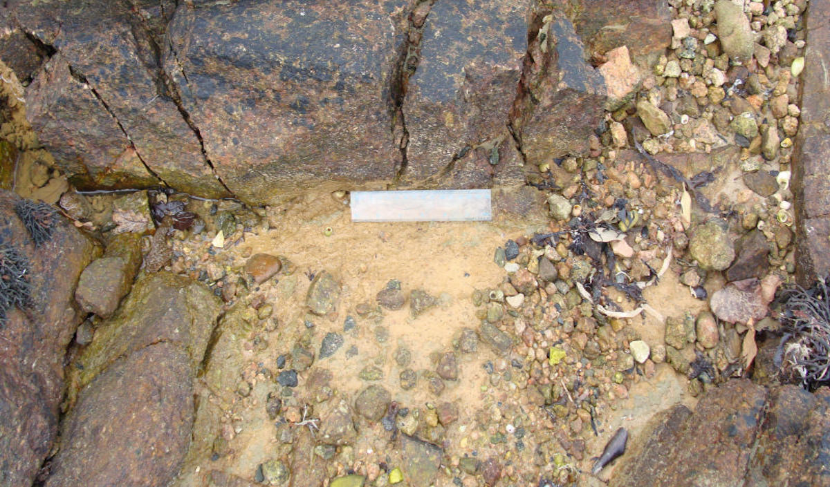
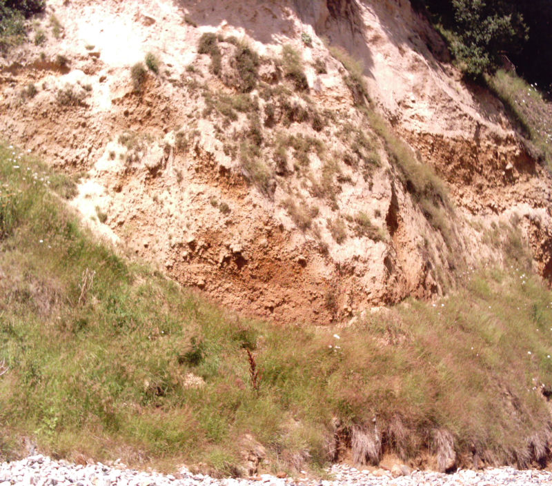
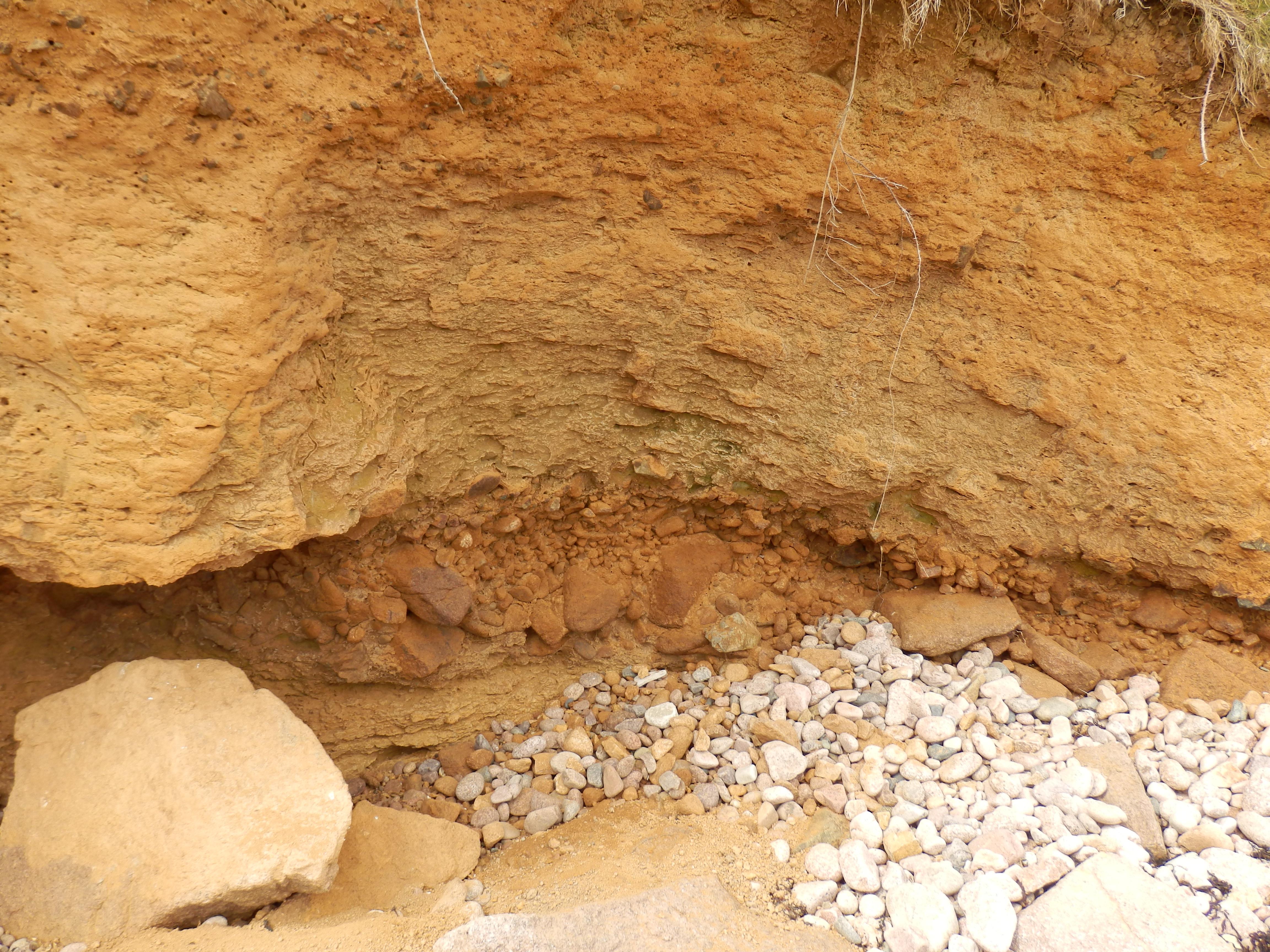
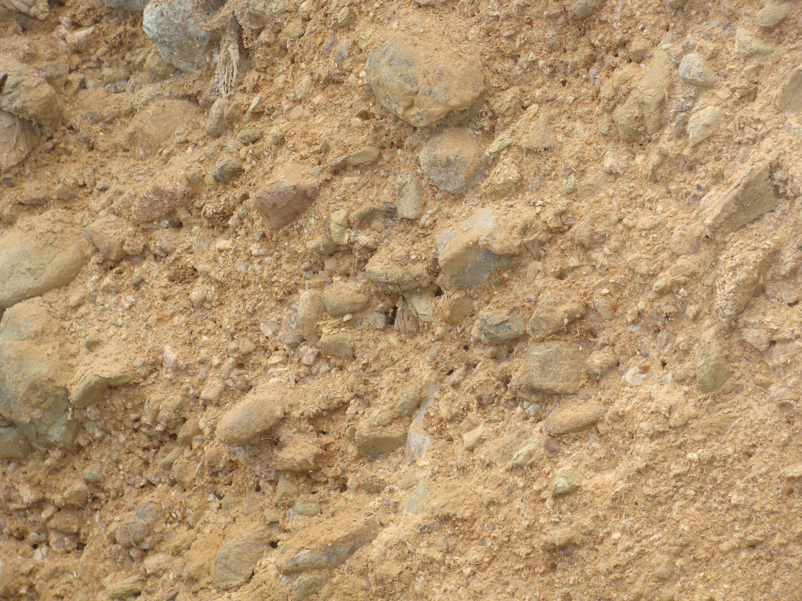
This is a deposit of angular, unsorted rock fragments in a sand-grit matrix which can show incipient stratification and which forms during glacial periods. The head was formed during freeze-thaw climatic conditions as a gelifluction deposit. An upper unstable layer flowed slowly down any gradient when the interstitial ice melted, and settled on lower lying, flatter surfaces. It is the cold climate version solifluction (Allaby & Allaby, 1999, p.225). In Jersey, there were two periods of head formation. The lower head occurs below the 8m raised beaches as at the back of Portelet Bay and north of Belcroute Bay and is dated as (?) pre-Ipswichian, while the upper head deposit is Devensian (Bishop & Bisson, 1989, p. 82).The upper head is found near the tops of cliffs overlying the bedrock right around the island. Thick deposits also occur in Beau Port and around Noirmont headland, and the volcanic rocks of Bonne Nuit and Bouley Bays. In all localities, from above the Rozel Conglomerate and volcanic rocks in the northeast to the granites and shales elsewhere, the fragments are from the bedrock. On granite cliffs they are granite (as to the east of La Grève de Lecq). Above those parent rocks in the north east of the island, they are Rozel Conglomerate and volcanic fragments, and elsewhere they are shale above the shale cliffs as at Le Pulec. Here (photo above), weakly stratified deposits lie above rounded pebbles of raised beach deposits in two narrow gullies down the south side of the slipway (see below) and extend upwards to overlie the adjacent eroded bedrock surfaces (Nichols & Hill, 2004, pp. 104 - 105). The lower head is dated as (?) pre-Ipswichian while the upper head deposit is Devensian (Bishop & Bisson, 1989, p. 82). |
||||||||||||||||||||||||||||||||||||||||||
Raised beaches (Ipswichian, Woolstonian to ?Hoxnian interglacials). |
||||||||||||||||||||||||||||||||||||||||||
 |
||||||||||||||||||||||||||||||||||||||||||
Part of former coastline east of St. Helier (shaded between c. 50 -100 feet), showing bays & valleys and possible beach areas. Duke of Richmond Map, 1795. |
||||||||||||||||||||||||||||||||||||||||||
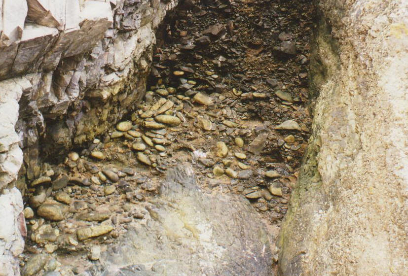
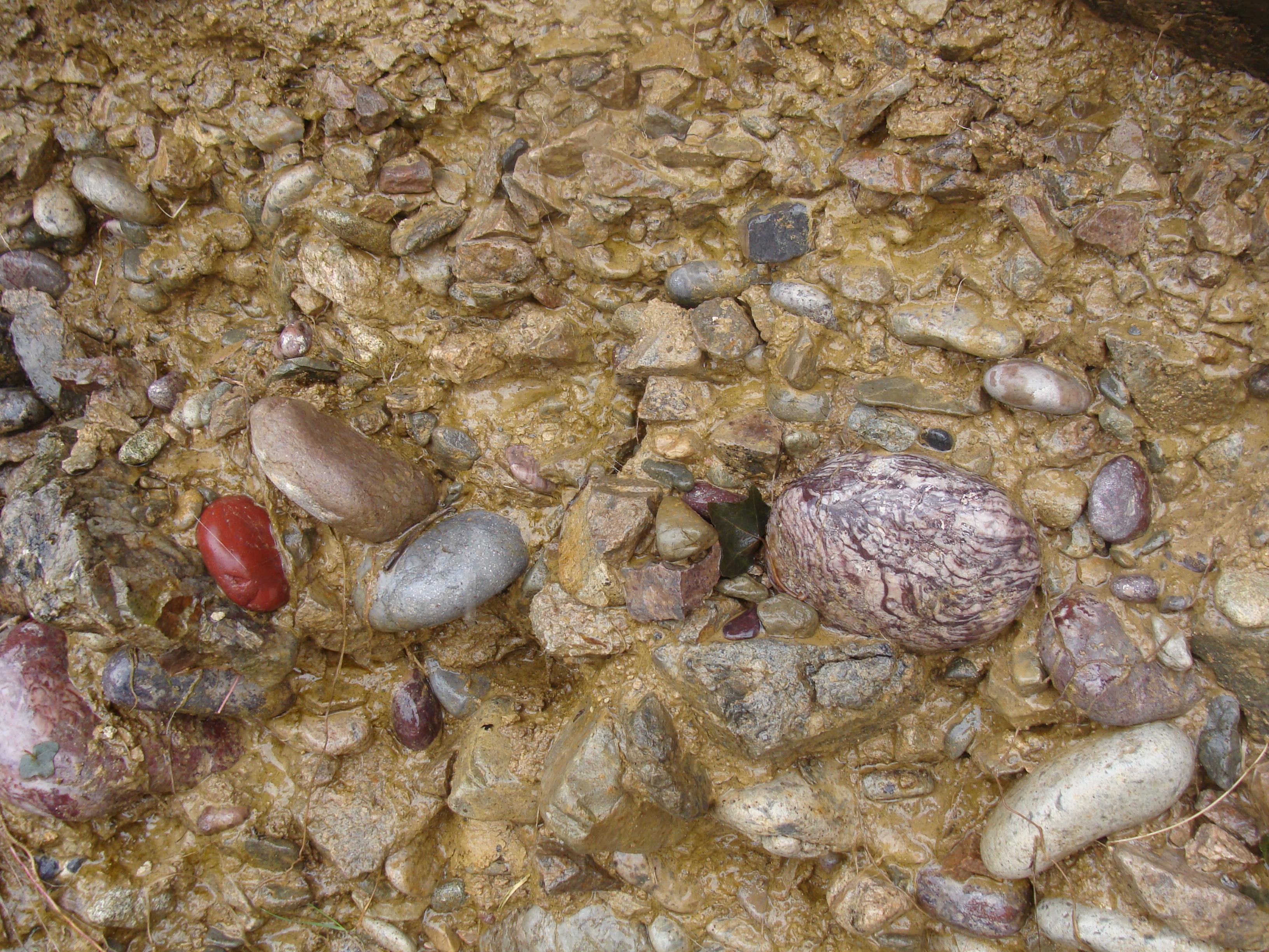
Raised beaches (pebble layers and gully deposits) at 8m, 18m and 30m (see below), occur in various sand, head and loess deposits in the cliffs at the backs of beaches, eg. Portelet Bay, near Belcroute Bay on the south coast, in Bonne Nuit and Giffard Bays on the north coast and in gullies eroded into the bed rock at Le Pulec ((photos below), near L'Étacq. They consist of pebbles of local rocks plus flints from sea bed chalk deposits, for example, the 30m raised beach gravels in a gulley at South Hill, St. Helier contains pebbles of the Fort Regent granophyre and quartz pebbles (Bishop & Bisson, 1989, p. 83). When weathered out during heavy rain or occasional freeze-thaw conditions, these cliff deposits form scattered additions to the beach deposits. Small present day scree or slump/slip deposits occur at the foot of these cliffs. The three main levels of raised beaches around the island, from lowest (youngest) to highest (oldest), are at 8m (Ipswichian, Keen, 1978, p.13; Ipswichian/Eemian (NW European stage name) Bishop & Bisson, 1989, p.86); 18m (?Woolstonian, Keen, 1978, p.13; pre-Ipswichian, Bishop & Bisson, 1989, p.82-3) and at 30m (Hoxnian, Keen, 1978, p.13; pre-Ipswichian, Bishop & Bisson, 1989, p.82). They are identified by rounded pebble deposits either in gullies in the bed rock or as strand lines within sand deposits. In rocky cliff areas, they are identified by grooves (wave-cut notches) at respective heights above MSL. Certain flat, bench areas and breaks of slope occur at higher levels, for example, at La Crête Point and inland (photo below, excluding the road level in the centre). |
||||||||||||||||||||||||||||||||||||||||||
 |
||||||||||||||||||||||||||||||||||||||||||
These are currently being researched throughout the Channel Islands (Dr. J. Renouf, pers. comm.) to determine former sea levels. Their formation may be a result of changes in sea level (eustatic changes) or in land height (isostatic changes) or a combination of both as the ice sheets melted. |
||||||||||||||||||||||||||||||||||||||||||
 |
||||||||||||||||||||||||||||||||||||||||||
Another exposure was found recently in the cutting of a private road to Bouilly Port at the western end of St. Brelade's Bay and seems to represent the remains of the 30m beach deposit in a gully in the SW granite. The oldest beach gravels, considered to form the 30m beach, can be seen on South Hill where they consist of medium size gravel of Fort Regent granophyre and quartz pebbles. Gravels and pebbles also crop out as a strand line below head in the south side of the road cutting west of St. Clément's Church. This may have represented a beach on the side of the lighthouse ridge (possibly a former headland). Other 18m beach cobbles and gravels occur with fine and coarse gravels of granite, shale and flint at Le Mont du Jubilé (Jubilee Hill, St. Ouën), while granite and flint medium size gravels in a gulley occur on the east side of the former railway terminus at Snow Hill, St. Helier (Renouf, 1969); Renouf & Bishop, 1971) and St. Clément (inner road cutting) and also as a cemented granite cobble deposit in caves at Le Grand Becquet. They are possibly remains of the mid-Pleistocene interglacial sea level rise c. 200,000 years ago. Former 8m beach rounded pebble gravels occur at the bottom of two possible gullies of a raised beach in the cliffs on the south side of Le Pulec slipway below the head deposits (mentioned above). The first is a shallow, broad gully/channel with rounded pebbles just exposed at the base (covered by grass at present) while the second, further down, is a narrow, steep sided gully with the pebbles clearly exposed at the base. The slipway, cut through the shales and head, provides sections through a type of buried landscape. The north wall is also a section of this, and it seems to contain the extensions of the two south-side gullies, which would have angled through the shales towards the cove. The first is a small exposure, containing some rounded pebbles which is cut off by a short section of granite wall covering a broad hollow to the cove; this seems to a continuation of the first shallow gully/channel on the south side. The second, further down, is only a narrow gully, devoid of deposits, but it seems to be an extension along the strike of the second steep sided one on the south side. |
||||||||||||||||||||||||||||||||||||||||||
 |
 |
|||||||||||||||||||||||||||||||||||||||||
Raised beach gravels in a former gully and channel below glacial head, Le Pulec, St. Ouën. |
||||||||||||||||||||||||||||||||||||||||||
The 8m beach pebbles and gravels are well exposed in the predominantly sand and head cliff sections at the back of Portelet Bay beach in St. Brelade where a layer (?strand) of large, local granite pebbles rests on head and is overlain by sand and head. Exposures of raised beach deposits also occur between St. Aubin's Harbour and Belcroute Bay in which rounded pebbles mixed with angular fragments (head?) lie on the eroded surface of the shales nearer St. Aubin. The best section along this traverse (Nichols & Hill, 2004) is now covered by a land slip but a pebble-cobble strand and the overlying stratified sands are described in detail and illustrated by Bishop, Keen, Salmon & Renouf, (2003, p. 21 - 25). |
||||||||||||||||||||||||||||||||||||||||||
 |
 |
|||||||||||||||||||||||||||||||||||||||||
Sand, raised beach & head Portelet Bay. |
Raised beach, pebbles & head, St. Aubin. |
|||||||||||||||||||||||||||||||||||||||||
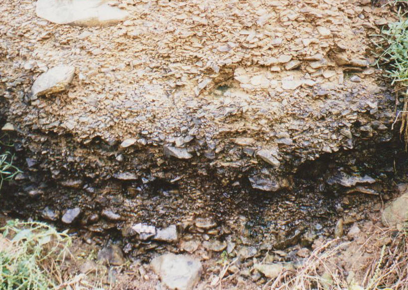
All along the back of Bonne Nuit Bay there is an excellent cliff section of the 8m beach with interbedded yellow silty clays (some laminated), thin raised beach gravel strands and gully accumulations (eastern end), and glacial head layers exhibiting well sorted intervals alternating with intervals containing scattered large angular blocks. Some of these intervals show wedging or thinning and seem to be truncated by overlying beds where a mid-section, pale grey bed, c. 30cm thick provides a good marker half way along the bay. The assemblage seems to represent some fluvial deposition, a marine advance, glacial head formation (gelifluction deposit) and some thin loess (aeolian) deposits. In addition to Mourant (1933, 1935) and Keen (1978), these deposits have also been described by Bishop & Bisson (1989, p. 83 and pp. 85-88). |
||||||||||||||||||||||||||||||||||||||||||
 |
 |
|||||||||||||||||||||||||||||||||||||||||
Variation in form of raised beach deposits, Bonne Nuit Bay east. |
||||||||||||||||||||||||||||||||||||||||||
 |
 |
 |
||||||||||||||||||||||||||||||||||||||||
Lagoon/pool silt lenses below pebbles & head. |
Iron - banding in the Head deposits. |
Glacial Head between dipping laminated silt (base) |
||||||||||||||||||||||||||||||||||||||||
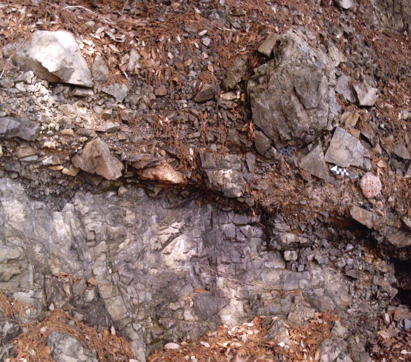
Two other interesting beach gravel deposits occur in Bonne Nuit beach under the present day large boulders. The first is a brown, well-cemented ferruginous pebble deposit with laminated coarse sand layers which lies on and against the bedrock c.10-15m from the end of the sea wall and c. 40m down beach. This is assumed to be the one described by Mourant (1935) and quoted by Keen (1978, p. 9) as "a coarse, iron cemented sandy shingle... attached to the rock platform" from Mourant (1933 &1935) who thought these "may be part of the 25ft (8m) beach but may represent a separate horizon". Keen (op.cit.) remarks that this is 'the only beach gravel seen'... although others recently found in the same area may not have been exposed in 1978. These others form the second deposit (second photos below), exposed in several places about 10-20m further east. This deposit is a different, non-ferruginous, semi-indurated, pebble deposit seemingly in a dark soil-like clay/head groundmass (not sampled). The exposures occur in various places under present day boulders, down-beach from the cliff section. Given the elevation difference between the two different beach gravel/pebble outcrops and the strand line of pebbles in the superficial deposits of the cliff, could they all be part of a diachronous 8m beach deposit? The source of iron may be from leaching of the overburden as illustrated by the middle photo above. The first type (first photo) is exposed down-beach from the eastern end of the seawall and occurs at about the same elevation as the second type. |
||||||||||||||||||||||||||||||||||||||||||
 |
 |
|||||||||||||||||||||||||||||||||||||||||
Rounded gravel in ferruginous grit, on and around Bonne Nuit ignimbrite, mid-tide Bonne Nuit beach. |
||||||||||||||||||||||||||||||||||||||||||
Meanwhile, a little further east along the ankle-testing boulder beach, the second type is exposed in several places under large boulders, 3-4m below the strand line in the cliff. |
||||||||||||||||||||||||||||||||||||||||||
 |
 |
|||||||||||||||||||||||||||||||||||||||||
Rounded gravel in clay/head? matrix under beach boulders (sep. sites), Bonne Nuit beach. |
||||||||||||||||||||||||||||||||||||||||||
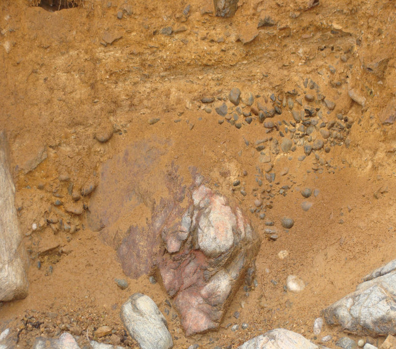
Another 8m beach level was found recently around Le Hougillon, a small headland of Rozel Conglomerate, between Bel Val cove and St. Catherine's Tower. Along this stretch there are several exposures of rounded pebble deposits lying on the eroded conglomerate surface and overlain by yellow glacial head and light brown soil. There are interesting occurrences of valves of Ostrea edulis found by Paul Chambers in the soil, the species which used to form the Gorey oyster beds and which were destroyed c.1880-1890 by the parasite Bonamia ostreae. O. edulis is now uncommon in our area, so this deposit must be earlier than the 1880s and occurs with limpets, dog whelks, and with charcoal fragments, possibly forming the remains of a 'poor man's meal' (Paul Chambers, pers. comm.). The context and relationships indicate that the deposits with shell remains have slumped - from above to partly cover the fossil beach. |
||||||||||||||||||||||||||||||||||||||||||
 |
 |
|||||||||||||||||||||||||||||||||||||||||
Raised beach, Le Hougillon, south Bel Val (left) and adjacent oyster valves & charcoal over possible raised beach/head channel (right photo centre). |
||||||||||||||||||||||||||||||||||||||||||
 |
 |
|||||||||||||||||||||||||||||||||||||||||
Raised beach, Le Malade, north Archirondel. |
Raised beach/Loess, Le Grouet, La Corbière. |
|||||||||||||||||||||||||||||||||||||||||
 |
 |
|||||||||||||||||||||||||||||||||||||||||
18m Raised beach, Fort Regent. |
30m Raised beach, St Clement. |
|||||||||||||||||||||||||||||||||||||||||
Recently found raised beach deposits (November 2015). |
||||||||||||||||||||||||||||||||||||||||||
South Hill. Recently, another exposure of the 40m raised beach was reported to Dr. Renouf who is researching the details. It has been covered with netting but well-rounded pebbles varying in size, seem to be of the surrounding of the granite. They are preserved in a loess-like matrix (Fig. 1) within a shallow channel. |
||||||||||||||||||||||||||||||||||||||||||
 |
||||||||||||||||||||||||||||||||||||||||||
Fig. 1. |
||||||||||||||||||||||||||||||||||||||||||
Le Petit Portelet. At the back of Petit Portelet, Gorey, there are striking yellow-brown cliffs at the back of the beach, which are predominantly made glacial head and loess. The erosion of a wave-cut notch at the base, together with the occasional land slip has revealed another example of a possible 8m raised beach, extending along much of the exposure (Fig. 2), but also showing lateral variation and thinning. The pebbles vary in size, rounding and composition, an interesting type being andesite (Fig. 3), presumably from the exposure further west (IGS 1: 25,000 Channel Islands Sheet 2, 1978/82). |
||||||||||||||||||||||||||||||||||||||||||
 |
 |
|||||||||||||||||||||||||||||||||||||||||
Fig. 2. |
Fig. 3. |
|||||||||||||||||||||||||||||||||||||||||
St. Catherine's Viviers. This raised beach is part of a mixed section where loess, head and the beach pebble strand are exposed on the south east side of Le Verclut hill, immediately alongside the western side of the Viviers building. The raised beach (Fig. 4) occurs in the lower part of the outcrop and is overlain by the thickness of head and loess (Fig. 5). |
||||||||||||||||||||||||||||||||||||||||||
 |
 |
|||||||||||||||||||||||||||||||||||||||||
Fig. 4. |
Fig. 5. |
|||||||||||||||||||||||||||||||||||||||||
Le Saie Harbour. Another example of a c.8m raised beach crops out at the back of a cove, half way between Saie Harbour and La Coupe in hollows eroded in the Rozel Conglomerate. The pebbles are of diorite, possibly andesite, ignimbrite and rhyolite and are well-rounded (Fig. 6 & 7). They vary in shape from sub-spherical to thin disc-shaped (4 - 8cm long) and in size from 1 - 15 cm, and occur in a brown-yellow loess matrix, indicating both interglacial and later glacial deposition. |
||||||||||||||||||||||||||||||||||||||||||
 |
 |
|||||||||||||||||||||||||||||||||||||||||
Fig. 6. |
Fig. 7. |
|||||||||||||||||||||||||||||||||||||||||
Giffard Bay. Here there is a short section of the 8m raised beach cropping out at the foot of the western end of the cliffs. The pebbles are well-rounded and range in colour from light grey to brown, red, and purple with white bands set in a yellow-brown matrix (Fig. 8) These are varieties of the local volcanic rocks, and rhyolite, jasper and flow-banded rhyolite can be seen. Above, lies glacial head, a mixture of angular fragments in a partly loess-looking matrix. |
||||||||||||||||||||||||||||||||||||||||||
 |
||||||||||||||||||||||||||||||||||||||||||
Fig. 8. |
||||||||||||||||||||||||||||||||||||||||||
La Grève au Lanchon. Here, a possible 18m beach infill occurs in a cleft above the 3rd. cave west, photo below. |
||||||||||||||||||||||||||||||||||||||||||
 |
||||||||||||||||||||||||||||||||||||||||||
References. Allaby, A. and Allaby, M. 1990. A Dictionary of Earth Sciences. 2nd. Ed. Oxford University Press. Bishop, A. C. & Bisson, G. 1989. Classical areas of British geology: Jersey: description of 1: 25,000 Channel Islands Sheet 2. (London: HMSO for British Geological Survey). Bishop, A. C., Keen, D. H., Salmon, S. and Renouf, J. T. 2003. Geology of Jersey, Channel Islands. Geologists' Association Guide No. 41. Harland. W. B., Armstrong. R. L., Cox. A. V., Craig. L. E., Smith. A. G. and Smith. D. G. 1990. A Geologic time scale 1989. Cambridge University Press. Jones, R. L., Keen, D. H., Birnie, J. F. & Waton, P. V. 1990. Past Landscapes of Jersey. Société Jersiaise. Keen, D. H. 1978. The Pleistocene deposits of the Channel Islands. Rep. Inst. Geol. Sci. No. 78/26. Mourant, A. E. 1933. The raised beaches and other terraces of the Channel Islands. Geol. Mag., Vol. 70, pp. 58-66. Mourant, A. E. 1935. The Pleistocene deposits of Jersey. Ann. Bull. Soc. Jersiaise. Vol. 12, pp. 489-496. Nichols, R. A. H. and Hill, A. E. 2004. Jersey Geology Trail. Private publication; printed by The Charlesworth Group. Renouf, J. T. 1969. Geological report for 1968. Ann. Bull. Soc. Jers. Vol. 20. pp. 15-16. Renouf, J. T. & Bishop, A. C. 1971. The geology of Fort Regent road tunnel. Ann. Bull. Soc. Jers. Vol. 20. pp. 275 - 283. Roberts, H. M. 2008. The development and application of luminescence dating to loess deposits: a perspective on the past, present and future. Boreas, Vol. 37, No. 4. pp. 483-507. Wiley -Blackwell. Wintle, A. G. 2008. Luminescence dating: where it has been and where it is going. Boreas, Vol. 37, No. 4. pp. 471-482. Wiley-Blackwell. |
||||||||||||||||||||||||||||||||||||||||||